The reality of virtual accident reconstruction.
Is there any industry left untouched by technology’s advance? Few remain outside the grasp of a computer link, a camera’s gaze, or a cellular phone connection—especially in the internet of things (IoT) era. For automotive engineers entrusted with post-accident investigations, the charge to modernize techniques comes with significant challenges. No matter how bright, shiny, and promising the technology, each must add demonstrable value to a rigorous analytical process and adhere to evidentiary standards set by the U.S. court system. There is no technology in the offing that will eliminate the role of the forensic engineer in accident investigations, but there are some high-tech resources that are highly accurate, prompt, and thorough that bring a real-time perspective to the analysis of the crash event, ultimately narrowing the interval between accident notification and claims resolution.
The Status Quo
Just like any service provider in recent years, automotive engineers who conduct accident investigations have had to evolve their data-gathering methods in order to stay competitive and relevant. Orange cones and tape measures still have their place in an investigator’s toolbox, but a slew of resources from digital cameras to tablets/laptops, laser mapping systems, and onboard vehicular data-gathering microprocessors have amplified their toolsets.
The scene inspection—either immediately following the crash event by law enforcement or later by an engineer to validate or supplement police report findings—adheres to standard protocols to collect evidence and determine the event sequence. The effort includes recording vehicle skid marks and other debris, points of rest, visible damage, and more. Everything is measured and photographed. Following the scene examination, the forensic engineer continues gathering evidence with detailed vehicle damage inspections; maintenance record reviews; evaluations of suspect vehicle components, like brakes or tires, to verify proper function; and measurement of any body panel deformation.
Data downloads from onboard event data recorders (EDR) are commonplace. They deliver critical data that details the crash sequence from vehicle speed and brake application to air bag deployment. As the engineer develops a comprehensive analysis of the crash event, he resolves or refutes any conflicts in the gathered data, disclosure documents, and contributing factors like weather, time of day, and road conditions. Ultimately, the analysis rides on mathematical proofs based on Newtonian laws of physics. What is the bottom line for insurers and attorneys who commission an engineer’s report? The costs are measured in time expended in pursuit of the answers.
Transforming Accident Scene Investigations
The tools debuting on the market these days can shorten the time between the cause of action and its resolution. Imagine retrieving a police report within days or even hours of a vehicle accident—a rarity lately with overburdened law enforcement resources. What about the possibility of tapping onboard systems in real time to deliver global positioning system (GPS) vehicle tracking and views from 360-degree cameras? With such resources at hand, virtual accident reconstructions almost are a possibility. Feasibility is a function of cost, of course, but there are a surprising number of choices to draw that prospect closer. Some may even be riding along in vehicles right now.
For instance, Google Glass may have had a rocky start in the consumer market, but for emergency medical technicians (EMTs) and paramedics, the use of optical head-mounted displays are helping them consult with trauma staff in real time while in transit to emergency rooms. With an EMT wearing the display and a hand-held tablet or laptop, a physician gets a gurney-side view and can significantly impact patient care for critical injuries or illnesses. The privacy issues that originally inflamed the public with the debut of Google Glass are not as significant in a health care application covered by HIPAA patient privacy standards.
Can a similar approach apply to law enforcement officers who are at the scenes of accidents and whose responsibilities to protect the rights of the accident victims are proscribed by law? By wearing devices like Google Glass at a crash site, the investigator could immediately assess and inventory the skid marks and debris field, vehicle location, point of rest, and physical damage for all affected parties and transmit the information in real time to headquarters. Integrating GPS data also would enable extremely accurate pictures of the accident scene. The latest Apple Watch, a GPS-enabled device, offers that very handy link to the headset wearer.
A head-mounted optical display like Google Glass also can facilitate real-time, post-accident analysis and conferencing among engineering experts. Much of a forensic engineer’s investigation takes place in junkyards where crashed vehicles take up residence following accidents. This is the time when the engineer invokes expertise and experience to arrive at a more profound understanding of the crash sequence, the causes, and the resulting damage. The advantage of a hands-free device is very clear; it records what the engineer sees and says and delivers an accurate testimony of the event as it happens. Often, the engineer is alone at the junkyard; other times, all interested parties join together to study the damaged vehicle. Use of the optical display interface can broaden the audience of participants and include the input of subject-matter experts who work remotely. Of course, due diligence must be paid to the interactions between the wearer of the optical display and the remote participant, since all such communications and recordings from the device are discoverable in litigation.
Drones on Accident Scenes
Another technological marvel that promises to shorten the timeline of accident investigations is the unmanned aerial vehicle (UAV), or drone. The investment cost is high for the technology, and Federal Aviation Administration (FAA) oversight means that there is significant legal liability in its misuse. The public is sensitive to related privacy issues, as well. However, for local law enforcement officials, deployment of a UAV to a crash site has distinct advantages. A skilled pilot can fly the drone immediately to an accident, map the scene, and transmit real-time information about the incident to headquarters and other first responder resources. Enhancements to the technology include thermal, gas, and radiation detectors, among others.
The gains from the use of drones are significant. It’s safer for investigators in dangerous situations; more accurate data is collected with fewer losses and inaccuracies; and for the public who must wait in traffic jams for the post-crash cleanup, drones offer speedier restoration of traffic flows. The high-quality accident data improves police reporting significantly, especially with the inclusion of GPS data, and, subsequently, will feed into the engineer’s analysis of crash causation. Drones are appearing in the toolboxes of forensic engineering firms, but for now, they are deployed to larger, and potentially costlier, investigations.
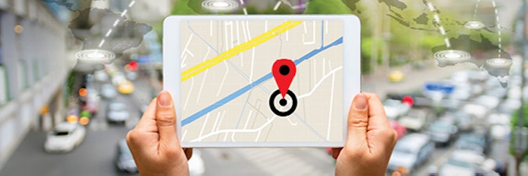
GPS Accuracy Skyrockets
A digital global positioning system (DGPS) is a companion technology for drone usage when documenting accident scenes. While GPS use is commonplace in vehicles, its accuracy is only between four and 20 meters. In contrast, with DGPS, satellite signals of vehicle locations are compared to precisely placed stationary DGPS ground receivers. A corrected—or augmented signal, as it is more commonly known—is sent to the receiver and is accurate to about one meter. Currently, law enforcement, military, and some civilian applications (surveying, for example) are citing 10-centimeter accuracy. Many state transportation departments already use DGPS to map their roadway infrastructure. By harnessing the augmented DGPS, these agencies are reducing infrastructure survey durations to hours rather than days, weeks, or even years for complete inventories. In yet another application, DGPS could be added to Google Glass, eliminating the need for an external link to location services. Forensic engineers wearing the device could use their locations to map extremely accurate accident scenes for later use in analysis.
Ultimately, GPS’ role here will transcend accident forensics and offer real-time accident avoidance for the full range of advanced vehicle technologies from driver assist and connected cars to autonomous vehicles, especially with the use of DGPS stationary ground receivers. For example, two vehicles tracked on a collision course via GPS/DGPS can be warned via an audible alarm or, in an automatic intervention, steered away from danger. Japan, a nation with pervasive GPS usage, is on the cutting edge of utilizing such satellite-enabled technologies.
Onboard Diagnostic Technology
Originally added by vehicle manufacturers in 1996 to monitor emission-control systems and to alert drivers of malfunction via the dreaded “check engine” light, onboard diagnostic (OBD) functions have been continually upgraded over the years and now include tire-pressure monitoring, fuel economy, miles driven, number of ignition on/off events, braking deceleration and ABS application, and wide-open throttle events. While there is controversy over accessing this portal, the OBD data could be included to supplement accident investigations. General Motor’s OnStar service, for example, enables the automaker to send driver alerts via their Proactive Alert feature for required maintenance and for components that are not functioning within their operating range (drivers must opt-in to use this feature). Another recent use of the OBD data port is Progressive’s Snapshot driver behavior monitoring tool to enable discounts for safe driving. SAE International and auto manufacturers are studying additional applications for data retrieval that will be valuable in crash investigations. Linking the data to services such as OnStar would provide immediate access at the crash site.
Much has been made of the use of crash data downloaded from onboard EDR in the past decade. In fact, data downloads are now standard operations for post-accident investigations when appropriate. EDR is linked to air bag deployment and records a rolling five-second summary of specific datasets prior to the air bag firing, but it is not equipped to record all events that may occur during an accident—OBD, in fact, offers a broader perspective. For example, in an accident in which a vehicle brushes against a guardrail, spins, exits the roadway, and hits a tree, the EDR only offers a fragmented view. The forensic engineer has to track the visible evidence on the roadway and the vehicle in order to piece together the event progression. OBD data can fill in gaps. Add the 360-degree camera used for lane-departure warning and self-parking options and gain a real-time view of the crash sequence. Of course, these accident avoidance features and options are not currently used in such a fashion, but with the application of the trigger threshold that activates OBD, it would be possible to record the event upon activation. Just like the EDR, the event could be overwritten by subsequent activations.
Closing Thoughts
If a virtual accident reconstruction is the goal of using advanced technology in crash investigations, that possibility is not yet on the horizon. It may only happen when the human factor is completely erased from the driving equation in the era of autonomous vehicles—although a recent fatal crash of a Tesla driverless vehicle utilizing the company’s autopilot feature reveals that more fine-tuning is necessary. In the meantime, there are high-tech answers to meet the need for real-time accident data that will speed up crash investigations. These new tools have game-changing potential, but they require strong caveats with use. For example, a drone pilot can do precise real-time surveys of accident scenes, but if the cause of the accident is the result of human error, the understanding of the crash event must include the points of view at street level of the accident participants and witnesses. Who can anticipate that evidentiary need better: a drone pilot or a trained accident investigator? It does not matter that the visuals from the drone are taken within minutes of the crash. Those images will be assets to the analysis, but they will supplement the conclusions of a trained human factors specialist who conducts a microlevel investigation. The same proviso applies to product liability claims in which a laboratory inspection of failed parts is standard—unless a component with a faulty algorithm shifts the examination to a systems engineer to unravel. A good part of a forensic analysis takes place at a desk with an engineer correlating disparate bits of evidence and crunching numbers and not hovering in the sky or downloading data sets. For now, it is the human factor that currently rules accident investigations.
Finally, as usage increases, each of these newer technologies will challenge the precepts and standard operations of insurers, attorneys, and accident investigators. Their journey to acceptability in the insurance industry and in the courtroom most certainly will follow the road already traveled by event data recorders and crash data retrieval.
Comparing reform efforts on time-limited demands
CLM’s Transportation Committee provides education, training, and solutions on significant current commercial and personal transportation issues facing insurance carriers, corporations, and other entities and individuals.

